Katima Mulilo (Katima Mulilo)
The nearest Namibian town to Katima Mulilo is Rundu, about 500 km away. About 40 km east of Katima Mulilo lies the village of Bukalo, where the road to Ngoma branches off that joins Namibia to Botswana.
Established and run as a garrison for a long time, Katima Mulilo still shows signs of its military role today. In the city centre was the South African Defence Force military base, almost every house had a bomb shelter. The town benefited from the military presence in terms of infrastructure and employment, and there are still a number of military bases surrounding the town.
Since the opening of the Katima Mulilo Bridge in 2004 that spans the Zambezi River and connects the Zambian Copperbelt with the Namibian deep sea harbour at Walvis Bay, Katima Mulilo has become a boom town that attracts significant investment. This development has, however, also fanned illegal business activities, and driven the establishment of shanty towns to an extent that endangers social stability.
The town features an Export Processing Zone and the largest open market in Namibia. There is an important international electricity inter–link facility, the Caprivi Link Inter–Connector; its inauguration has improved the power supply to the town. The Zambezi Waterfront Tourism project is under construction. The Caprivi Vision, a newspaper from and for the Caprivi, is published in town.
Since being proclaimed a town on 2 October 1999, development has been steady but Katima Mulilo does not yet compare to more established towns and cities in Namibia. Few streets are tarred, and there is a lack of street lights and sewerage. Many residents use the bushes for lack of toilet facilities, and there have been many outbreaks of diseases such as diarrhea.
The town has been affected by corruption, financial mismanagement, and infighting between councillors. Water supply has been unstable because money is owed to the national water supplier, NamWater.
Map - Katima Mulilo (Katima Mulilo)
Map
Country - Namibia
 |
 |
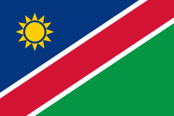
| Flag of Namibia | |
The driest country in sub-Saharan Africa, Namibia has been inhabited since pre-historic times by the San, Damara and Nama people. Around the 14th century, immigrating Bantu peoples arrived as part of the Bantu expansion. Since then, the Bantu groups, the largest being the Ovambo, have dominated the population of the country; since the late 19th century, they have constituted a majority. Today Namibia is one of the least densely populated countries in the world.
Currency / Language
| ISO | Currency | Symbol | Significant figures |
|---|---|---|---|
| NAD | Namibian dollar | $ | 2 |
| ZAR | South African rand | Rs | 2 |
| ISO | Language |
|---|---|
| AF | Afrikaans language |
| EN | English language |
| DE | German language |
| HZ | Herero language |


